
Severe weather is expected across parts of Florida, Alabama, and Mississippi today, with the arrival of Hurricane Francine. The storm, currently hovering near Category 2 strength, is bringing damaging winds, heavy rain, and the threat of tornadoes.
While some areas are enjoying sunny skies, the Gulf Coast is preparing for intense weather conditions.
High Pressure Brings Calm to the Northeast
For residents in the Northeast, things are looking good. High-pressure systems are keeping the skies clear, and temperatures are expected to stay between 80-85°F in states like New York, Pennsylvania, and New Jersey through the weekend.
There’s no rain forecasted for the area, making it a pleasant time for outdoor activities. But the weather story is very different in the Southeast and Gulf Coast.
Hurricane Francine Nears Landfall
The Gulf Coast is bracing for the impact of Hurricane Francine. Winds are currently recorded at 90 mph, just 6 mph short of being classified as a Category 2 hurricane.
The storm is expected to make landfall later this afternoon or evening along the central to eastern coast of Louisiana. By that time, wind speeds could exceed 100 mph, causing significant damage to structures and property.
Storm surge, one of the main dangers of a hurricane, will be a major concern along coastal areas. This surge will likely lead to flooding, especially in low-lying regions.
However, it’s not just the storm surge that residents need to worry about. Severe weather is expected to spread inland, bringing with it strong winds, heavy rain, and tornadoes.
Severe Weather Threatens Southeast States

As Hurricane Francine makes landfall, severe weather will extend beyond the coastal areas. The Florida Panhandle, Mississippi, Alabama, interior Louisiana, Arkansas, Tennessee, and possibly parts of western Georgia are expected to experience severe thunderstorms.
These storms will bring damaging winds, frequent lightning, torrential rain, flooding, hail, and the potential for brief tornadoes.
The National Weather Service is likely to issue tornado and severe thunderstorm watches as the day progresses. Residents in the affected areas should be prepared for sudden changes in weather, and it is recommended to stay indoors and avoid unnecessary travel during this time.
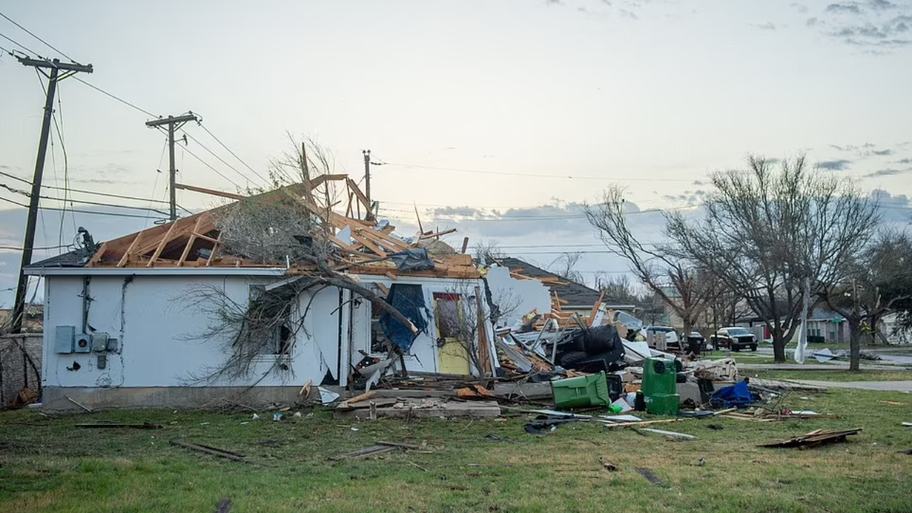
Tornadoes and Damaging Winds: What to Expect
A landfalling hurricane often brings with it severe weather, and Francine is no exception. Tornadoes are a significant risk today, with brief but powerful tornadoes expected to form in the outer bands of the storm.
These tornadoes can cause widespread damage, and residents are urged to remain vigilant, especially those in mobile homes or less sturdy buildings.
Damaging winds are another concern. Winds associated with the storm will be strong enough to knock down trees and power lines, leading to power outages in several areas. Homeowners are advised to secure outdoor furniture, trim loose branches, and make sure all windows and doors are properly sealed.
Heavy Rain and Flooding Expected
In addition to tornadoes and high winds, torrential rain will sweep across the Gulf Coast and move inland. This heavy rain could cause flash flooding in certain areas, particularly in low-lying regions and urban centers.
Drivers should be cautious and avoid driving through flooded areas, as water levels can rise quickly, leading to dangerous situations.
Flooding is also a concern for rivers and streams, as heavy rain may cause them to overflow. Local authorities may issue flood warnings, and residents should keep a close watch on the latest updates.
Florida’s Atlantic Coast Facing Strong Winds and Rain
While the Gulf Coast prepares for Hurricane Francine, the Atlantic Coast of Florida is also set to experience severe weather. Tropical energy from the storm is drawing moisture into the central and northern Atlantic Coast of Florida, bringing with it embedded thunderstorms.
Damaging winds, heavy rain, and the risk of waterspouts are expected near coastal areas throughout the day.
Related News:
- Alabama Braces for Chilling Weather as Wet Weather System Descends, Sending Temperatures Plummeting Across the State
- Alert Severe Storms on the Horizon – Texas, Mississippi, and Ohio River Valley Brace for Intense Weather Race
Stay Alert and Be Prepared
Residents of Florida, Alabama, Mississippi, and other affected states should remain on high alert today as the severe weather moves in. It’s essential to monitor local news and weather updates, as conditions can change quickly.
Be sure to have an emergency kit ready, including food, water, flashlights, and other essentials in case of power outages or evacuation orders.
By staying informed and prepared, you can minimize the risks posed by this severe weather event.