
The National Weather Service (NWS) forecasters are providing a final update on the amount of snow, freezing rain, and sleet that Pennsylvania can anticipate by this weekend as the state gets ready for yet another winter storm.
The NWS is now forecasting the heaviest winter weather from late Wednesday night into Thursday early, despite prior forecasts that called for snow in central Pennsylvania by Wednesday afternoon.
The NWS stated that a winter weather advisory will be in effect from 10 p.m. on Wednesday through noon on Thursday, affecting Adams, Cumberland, Dauphin, Lancaster, Lebanon, York, Perry, Franklin, Mifflin, and Juniata Counties.
Just after 6 p.m. on Wednesday, the NWS reported on X that there was little or no snowfall in Pennsylvania as of yet. But according to analysts, it will take one to two hours for mixed precipitation to begin to fall in some areas of the state.
There is still only a flutter or two of that band that has been spotted over Central #PAwx all day making their way to the ground. It won’t be long (1-2 hours) until some mixed precipitation falls over southern Pennsylvania.vVi2N2asVf pic.twitter.com/
There is a risk of snow in Harrisburg, Lancaster, York, Chambersburg, Carlisle, and Lebanon for a few hours after midnight. This will be followed by freezing rain and sleet that will last until Thursday. On Wednesday night and Thursday afternoon, the NWS warned that there could be significant snowfall at times.
Central Pennsylvania is predicted to have little to no ice buildup on Wednesday night, but by Thursday, the NWS warned that accumulations of less than a tenth of an inch might occur.
Forecasters predict that a region of western Pennsylvania municipalities, including Somerset, Johnstown, and the surrounding areas, will experience the most ice/freezing rain. By Thursday morning, those regions may receive 1 to 2 inches of snow and a quarter to half inch of ice. A severe storm warning is in force from Wednesday at 7 p.m. until Thursday at noon.
Although most of Pennsylvania should see sunny skies on Friday, winter isn’t quite finished yet.
According to the NWS, Harrisburg could see up to 1 inch of sleet and snow accumulation on Saturday, along with further snow, freezing rain, and sleet.
According to the NWS, York and other areas of central Pennsylvania might see 1 to 2 inches of snow and sleet accumulation by Saturday evening.
All snow, freezing rain, and sleet are expected to gradually transform into regular rain by Saturday night, according to the NWS, before bright skies return to the area on Sunday.
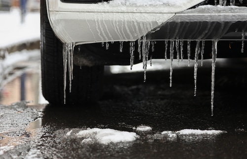
Despite their apparent similarities, freezing rain and sleet are two different types of precipitation. When liquid rain hits frozen surfaces, it turns into freezing rain, which rapidly makes sidewalks, roadways, and other surfaces treacherous.
As significant freezing rain is predicted for tonight and tomorrow, it’s critical to keep in mind how hazardous freezing rain may be:Risky TravelAbsence of powerWalking surfaces that are slippery #PAwxpic.twitter.com/xzexMbrK7H
However, liquid rain that freezes, partially melts, and then re-freezes before hitting the ground is known as sleet. Ordinary snowflakes only freeze once as they fall.