
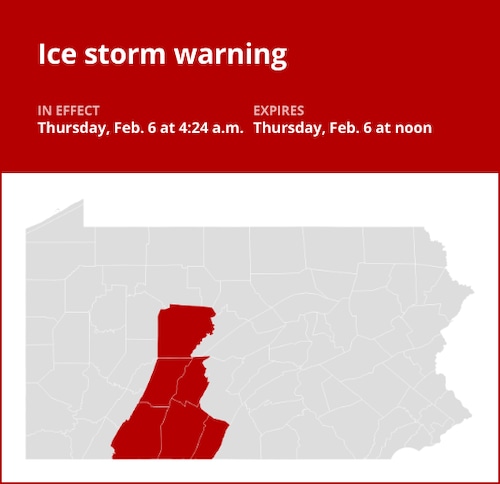
At 4:24 a.m. on Thursday, the National Weather Service issued an updated ice storm warning that will be in force until noon in the counties of Clearfield, Cambria, Blair, Somerset, Bedford, and Fulton.
“This morning, significant icing is anticipated. According to the meteorological service, there will be a quarter to a half inch of ice buildup from freezing rain and some sleet precipitation of an inch or less. For the majority of the period, freezing rain will be the predominant kind of precipitation. Temperatures will rise above freezing in the morning, eliminating the possibility of freezing rain. Wind gusts of up to 20 to 30 mph are predicted, which will cause power outages as tree limbs are likely to break and strike power lines. Highs in the 40s will be reached in the afternoon.
“Account for the possibility of slick roads. The weather service says the dangerous conditions can affect the morning commute. “We strongly advise against traveling. If you have to go, make sure your car has food, drink, and an additional flashlight in case of an emergency. Be ready for any power disruptions. You can dial 5 1 1 to get the most recent road conditions for the state you are calling from.
United Robots offers a service called Advance Local Weather Alerts that gathers the most recent information from the National Weather Service using machine learning.