
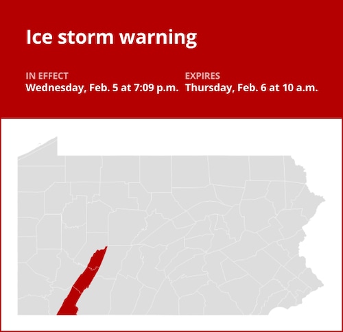
The National Weather Service issued an updated ice storm warning for Westmoreland Ridges, Fayette Ridges, and Higher Elevations of Indiana on Wednesday at 7:09 p.m., which will remain in force until Thursday at 10 a.m.
According to the weather service, “Significant icing is expected.” Ice accumulations range from a quarter of an inch to about four tenths of an inch, while snow accumulations are minimal or nonexistent.
“The ice is probably to blame for tree damage and power disruptions. It might be almost impossible to travel. The meteorological agency warns that the dangerous circumstances may affect commuters on Wednesday evening and Thursday morning. “Please report ice accumulations or damage by calling 412-262-1988, posting to the NWS Pittsburgh Facebook page, or using Twitter @NWSPittsburgh.”
United Robots offers a service called Advance Local Weather Alerts that gathers the most recent information from the National Weather Service using machine learning.