
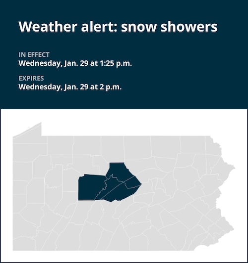
At 1:25 p.m. on Wednesday, the National Weather Service updated its forecast, predicting snow showers through 2 p.m. for Clearfield County, Northern Clinton, Northern Center, and Southern Clinton.
“At 1:20 p.m., a heavy snow shower was located along a line extending from near Lock Haven to 11 miles east of Punxsutawney and moving southeast at 30 MPH,” according to the National Weather Service.
On Interstate 80, particularly in the higher terrain of Clearfield, Centre, and Clinton counties, the roads may be covered in snow and slick from mile markers 97 to 193. Heavy snow showers will also affect Interstate 99 from mile markers 56 to 85. This includes the areas between the Dubois and Mile Run exits. Before the temperature drops by five to ten degrees, some rain could be mixed in with the snow at the beginning, turning any mixture into pure snow.
The following areas should see snow showers:
“If you have to travel through or into heavy snow, exercise extra caution,” the weather agency advises. Accidents may occur due to slick roadways and abrupt changes in visibility. Think about postponing your trip.
United Robots offers a service called Advance Local Weather Alerts that gathers the most recent information from the National Weather Service using machine learning.