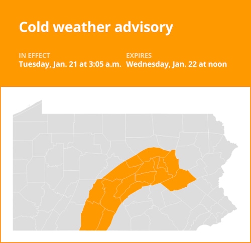
The National Weather Service issued a revised cold weather advisory on Tuesday at 3:05 a.m. that will be in force until Wednesday at noon for Blair, Huntingdon, Bedford, Fulton, Union, Snyder, Montour, Northumberland, and Columbia counties, as well as Southern Centre, Southern Clinton, and Southern Lycoming.
“Very cold wind chills as low as 15 below zero expected,” the weather agency says. “The lowest wind chills will be during the late night and early morning hours.”
The weather service warns that “if precautions are not taken, frostbite and hypothermia are possible.” “Wear layers if you have to go outside. To lower the risk of hypothermia or frostbite, cover any exposed skin.
Understanding cold weather alerts
Warning of cold weather: Exercise caution. When seasonably cold air temperatures or wind chill values—but not exceptionally severe ones—are anticipated or happening, a cold weather advisory is issued. When you and your loved ones go outside, make sure you cover any exposed skin and wear suitable clothing.
Warning: Extreme cold: Act now! When dangerously low air temperatures or wind chill values are predicted or already occurring, an extreme cold warning is issued. Avoid venturing outside if there is an extreme cold warning in effect. Make sure at least one other person is aware of your whereabouts, wear layers if you must go outside, and cover any exposed skin. When you reach your destination safely, update them.
Be ready for extreme cold watch. When extremely low air temperatures or wind chill values are possible, an extreme cold watch is issued. As with a warning, change your plans so that you don’t spend the coldest hours of the day outside. Update your winter survival gear and make sure your car has at least half a tank of gas left.
United Robots offers a service called Advance Local Weather Alerts that gathers the most recent information from the National Weather Service using machine learning.

